I’m thinking about narration and narratives and sharing recently.
Doug Fishbone and friends – Adventureland Golf, a conceptual-art miniature golf course
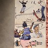
Bite – Felt Up, strange stories told via puppets
Why people love to get lost in books, a brief essay
100 books that SHOULD be written
Four Literary Short Films, “like a music video, for books.”
Outside Lands podcast, history and preservation in San Francisco
Do You Speak Science, a blog about science and words
Trayvon Redux, a poem by Rita Dove
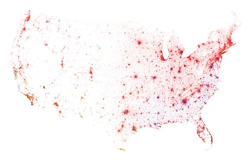
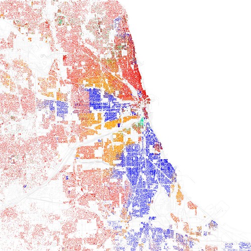
Hi, moments of narratives, shown on maps
Bagels and Grits, a just-starting-out paired-photo blog in the spirit of 3191 Miles Apart and Hipsters and Clogs
Hacking Teddy Ruxpin, exactly what you think it is
Incomplete manifesto for growth, a set of guidelines
750 Words, a site that is sort of a gamification of daily writing